

Related Post:
(Click on any of the images to see a larger version.)
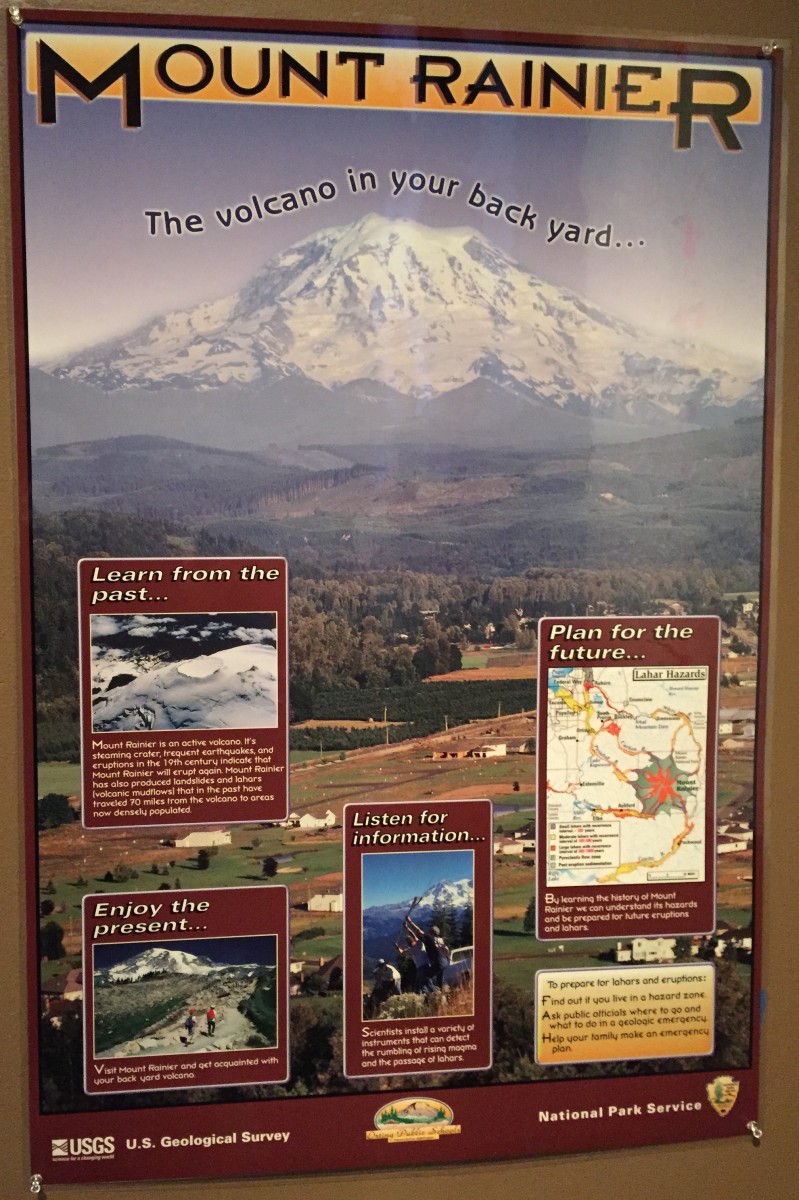
Mount Rainier is so beautiful and majestic to see that it’s easy to forget how potentially dangerous it is. Here in Tacoma, WA, we live in the shadow of this active volcano:

Washington is home to five major composite volcanoes or stratovolcanoes (from north to south): Mount Baker, Glacier Peak, Mount Rainier, Mount St. Helens, and Mount Adams. These volcanoes and Mount Hood to the south in Oregon are part of the Cascade Range, a volcanic arc that stretches from southwestern British Columbia to northern California.
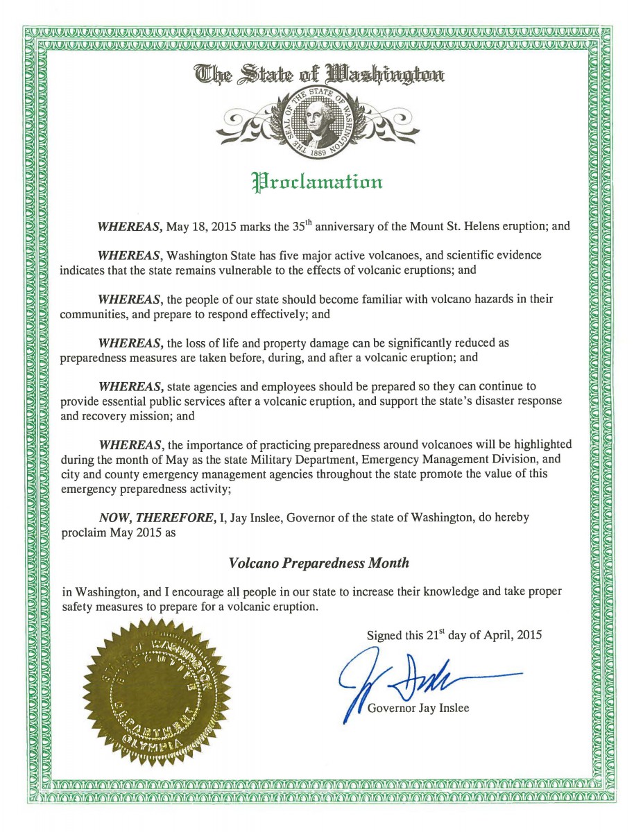
In conjunction with the anniversary of the eruption of Mount St. Helens on May 18, 1980, May is Washington State Volcano Preparedness Month:
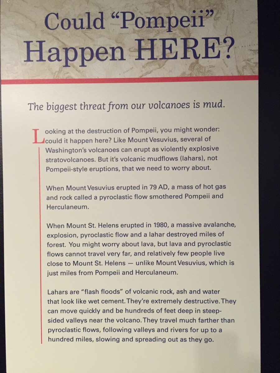
The Washington State History Museum presented an exhibit earlier this month entitled “Living in the Shadows” to remind the public that what happened at Mount St. Helens could happen here:
When most people think of the danger of a volcanic eruption, they think immediately of flowing lava. But there are two more immediate and potentially widespread dangers:
- lahars—volcanic mudflows
- pyroclastic flows—ground-hugging avalanches of hot volcanic ash, pumice, rock fragments, and gases that destroy everything in their path

As part of the state’s volcano preparedness program, students perform annual lahar drills in which they practice evacuating their schools ahead of lahar:
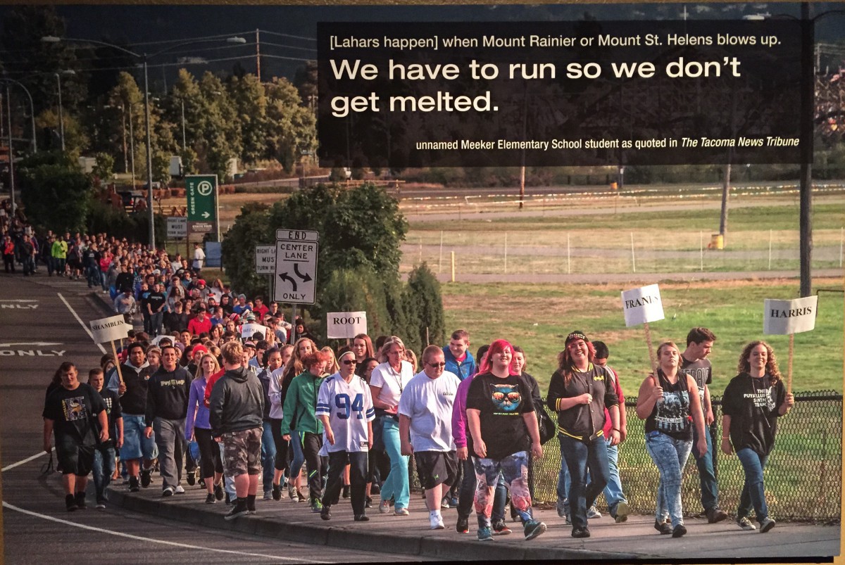
Also see the local news article Orting schools conducting lahar drill Thursday.
On our recent visit to see Pompeii: The Exhibition, we found the Pacific Science Center in Seattle used the eruption of Mount Vesuvius in Italy in 79 A.D. as a springboard for education about our local situation:
This map shows the potential danger zones if Mount Rainier were to erupt:
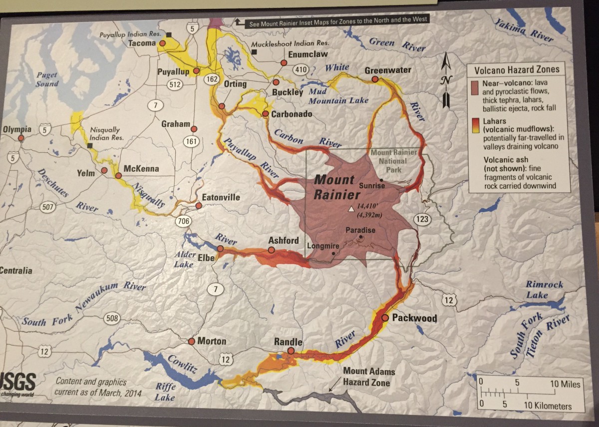
My home town of Tacoma is up there near the top, on the left.
The beautiful Cascades have been around for years. Long before the USGS (U. S. Geological Survey) started keeping records, Native Americans knew of the mountains’ power:

Washington’s Volcano Preparedness Month announcements and activities remind us that it’s not a question of “if Mount Rainier erupts,” but rather “when Mount Rainier erupts.”
Additional Resources
35 years after Mount St. Helens erupted: A new world of research
Dzurisin, D., Driedger, C.L., and Faust, L.M., 2013, Mount St. Helens, 1980 to now—what’s going on?: U.S. Geological Survey Fact Sheet 2013–3014, v. 1.1, 6 p. and videos. (Available at http://pubs.usgs.gov/fs/2013/3014/)
Recent News Articles about Erupting Volcanoes
Did she blow? NW submarine volcano likely just erupted
Scientists find missing link in Yellowstone plumbing: This giant volcano is very much alive
